|
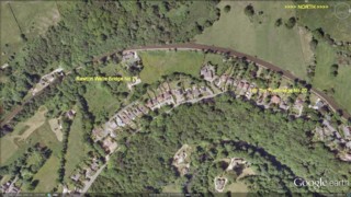
Marpleridge |
 |
Click to enlarge - Cliquer pour agrandir |
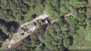
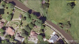
The Peak Forest Canal seen by Google Earth.
|
| Le Canal de Peak Forest vu par Google Earth. |
8-08-2010
Click to enlarge - Cliquer sur l'image pour agrandir |
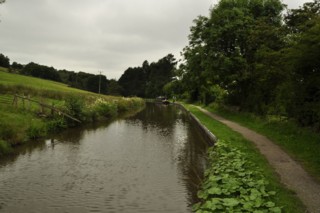
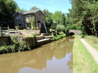
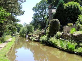
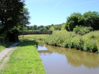
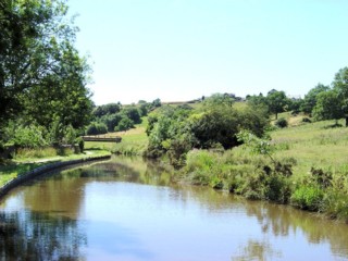
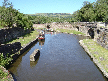
Looking to the North, the Peak Forest Canal to the South of Rawton Walls Bridge No.21.
|
| Les regards portés vers le Nord, le Canal de Peak Forest au Sud du Pont n°21 des Murs de Rawton. |
15-07-2006
Click to enlarge - Cliquer pour agrandir |
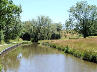
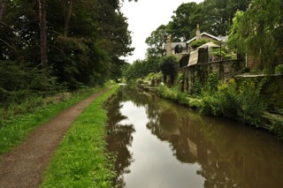
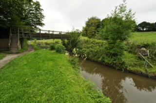
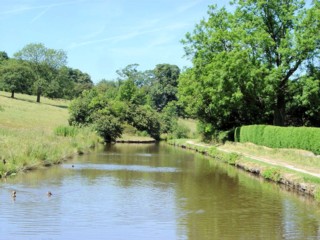
Looking to the South, the Peak Forest Canal to the South of Rawton Walls Bridge No.21
|
| Les regards portés vers le Sud, le Canal de Peak Forest au Sud du Pont n°21 des Murs de Rawton. |
15-07-2006
Click to enlarge - Cliquer pour agrandir |
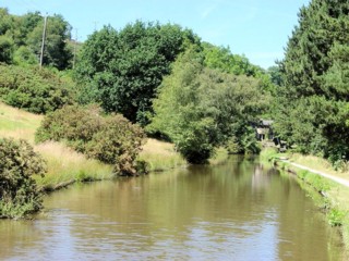
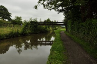
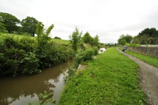
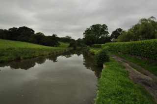
Looking to the North, the Peak Forest Canal to the South of Rawton Walls Bridge No.21
|
| Les regards portés vers le Nord, le Canal de Peak Forest au Sud du Pont n°21 des Murs de Rawton. |
15-07-2006
Click to enlarge - Cliquer pour agrandir |
8-08-2010
Click to enlarge - Cliquer sur l'image pour agrandir |
|
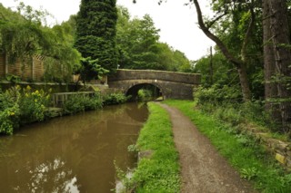
Rawton Walls Bridge No.21 seen from the South. |
Le Pont n°21 des Murs de Rawton vu du Sud. |
15-07-2006
Click to enlarge - Cliquer pour agrandir |
8-08-2010
Click to enlarge - Cliquer sur l'image pour agrandir |
|
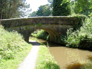
Rawton Walls Bridge No.21 seen from the North. |
Le Pont n°21 des Murs de Rawton vu du Nord. |
Click to enlarge - Cliquer sur l'image pour agrandir |
Rawton Walls Bridge No.21 seen by Google Earth.
|
| Le Pont n°21 des Murs de Rawton vu par Google Earth. |
15-07-2006
Click to enlarge - Cliquer pour agrandir |
8-08-2010
Click to enlarge - Cliquer sur l'image pour agrandir |
|
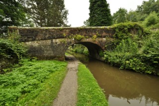
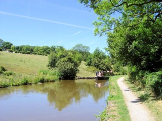
Looking to the South, the Peak Forest Canal seen from Rawton Walls Bridge No.21 |
Les regards portés vers le Sud, le Canal de Peak Forest vu du Pont n°21 des Murs de Rawton. |
8-08-2010
Click to enlarge - Cliquer sur l'image pour agrandir |
Hill Top Footbridge No.20 seen from the South.
|
| La Passerelle n°20 du Sommet de la Colline vue du Sud. |
Click to enlarge - Cliquer sur l'image pour agrandir |
Hill Top Footbridge No.20 seen by Google Earth.
|
| La Passerelle n°20 du Sommet de la Colline vue par Google Earth. |
15-07-2006
Click to enlarge - Cliquer pour agrandir |
8-08-2010
Click to enlarge - Cliquer sur l'image pour agrandir |
|
Turflea Lift Bridge No.22 seen from the North. |
La Passerelle n°20 du Sommet de la Colline vu du Nord. |
8-08-2010
Click to enlarge - Cliquer sur l'image pour agrandir |
Looking to the North, the Peak Forest Canal seen from Hill Top Footbridge No.20.
|
| Les regards portés vers le Nord, le Canal de Peak Forest vu de la Passerelle n°20 du Sommet de la Colline. |
15-07-2006
Click to enlarge - Cliquer pour agrandir |
Looking to the South, the Peak Forest Canal to the North of Hill Top Footbridge No.20
|
| Les regards portés vers le Sud, le Canal de Peak Forest au Nord de la Passerelle n°20 du Sommet de la Colline. |
15-07-2006
Click to enlarge - Cliquer pour agrandir |
8-08-2010
Click to enlarge - Cliquer sur l'image pour agrandir |
|
Looking to the North, the Peak Forest Canal to the North of Hill Top Footbridge No.20. |
Les regards portés vers le Nord, le Canal de Peak Forest au Nord de la Passerelle n°20 du Sommet de la Colline. |
15-07-2006
Click to enlarge - Cliquer pour agrandir |
To the North of Turflea Lift Bridge No.22
|
| Au Nord de la Passerelle n°20 du Sommet de la Colline. |
|
Visitez/Bezoek/Visit
Click on the image - cliquer sur l'image |
|
Peak Forest Canal |
|
|