|
Liverpool Docks
Between Brunswick Dock and Wapping Bridge |
 |
Click to enlarge - Cliquer pour agrandir |
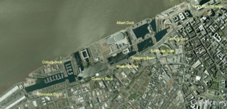
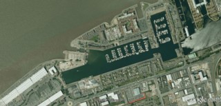
Liverpool South Docks seen by Google Earth.
|
| Les bassins au sud de Liverpool vu par Google Earth. |
Credit: Sabre Click to enlarge - Cliquer sur l'image pour agrandir |
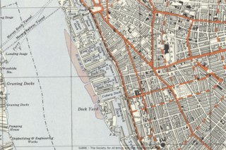
Old Ordnance Survey Map of Liverpool South Docks.
|
| Ancienne carte topographique du site des bassins au sud de Liverpool. |
29-08-2012
Click to enlarge - Cliquer pour agrandir |
Southern part of Brunswick Dock seen from the South.
|
| La partie sud du Dock de Brunswick vue du Sud. |
29-08-2012
Click to enlarge - Cliquer pour agrandir |
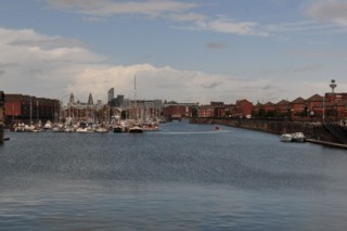
Northern part of Brunswick Dock seen from the South.
|
| La partie nord du Dock de Brunswick vue du Sud. |
29-08-2012
Click to enlarge - Cliquer pour agrandir |
Northern part of Brunswick Dock seen from the North.
|
| La partie nord du Dock de Brunswick vue du Nord. |
Click to enlarge - Cliquer pour agrandir |
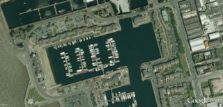
Brunswick Dock seen by Google Earth.
|
| Le Dock de Brunswick vu par Google Earth. |
29-08-2012
Click to enlarge - Cliquer sur l'image pour agrandir |
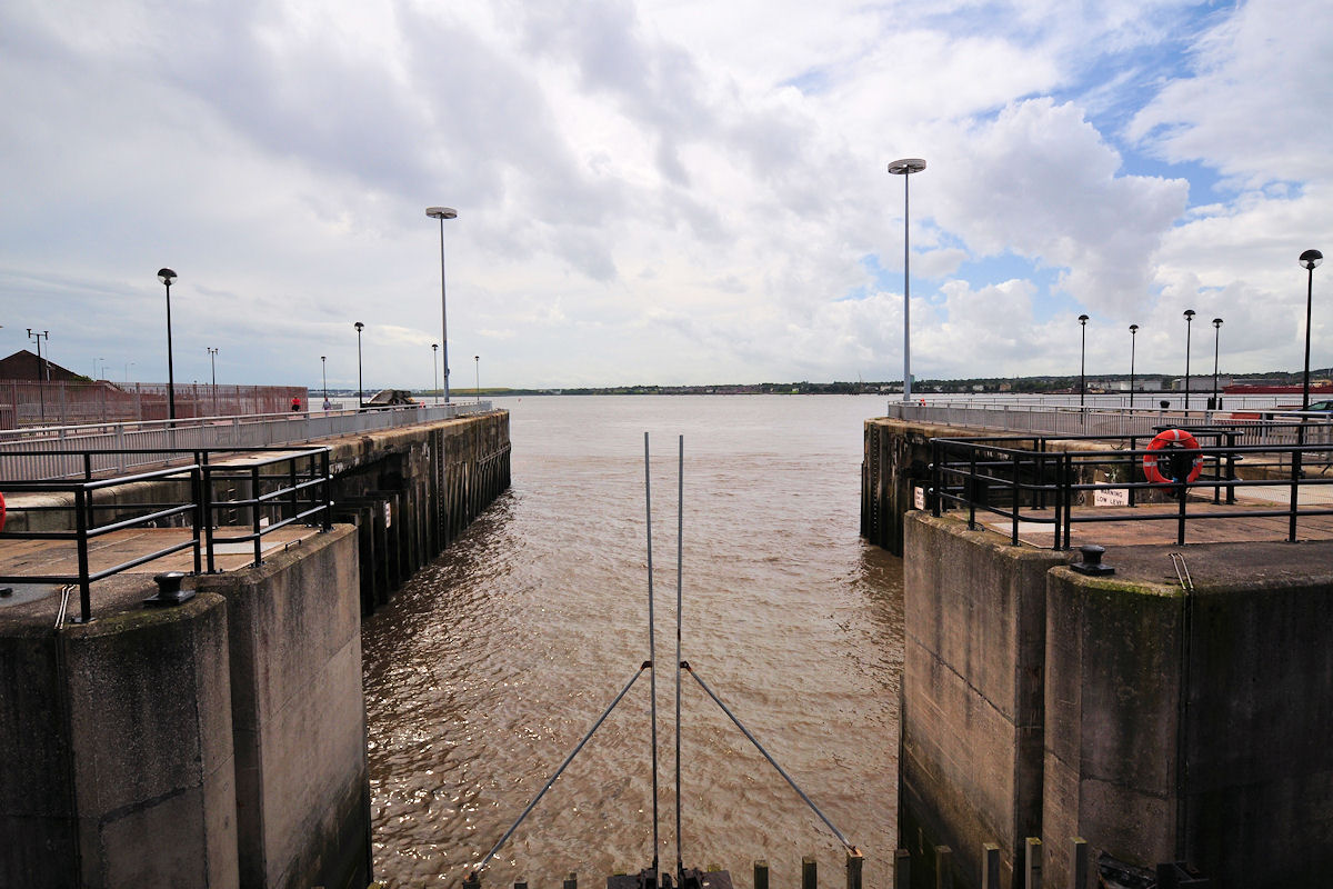
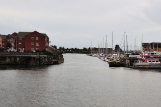
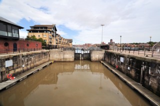
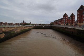
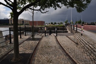
Brunswick Dock Lock seen from the South.
|
| L'Écluse du Dock de Brunswick vue du Sud. |
Click to enlarge - Cliquer sur l'image pour agrandir |
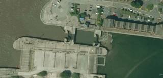
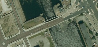
Brunswick Dock Lock seen by Google Earth.
|
| L'Écluse du Dock de Brunswick vue par Google Earth. |
29-08-2012
Click to enlarge - Cliquer sur l'image pour agrandir |
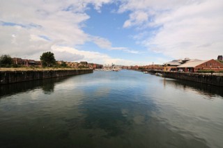
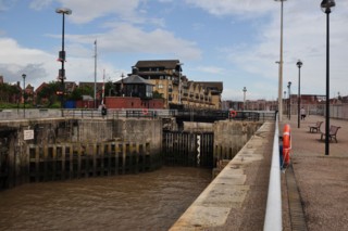
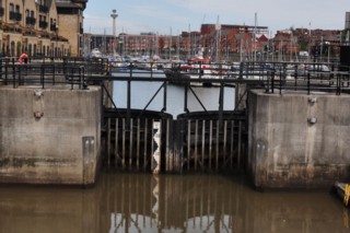
Brunswick Dock Lock seen from the Lock Footbridge.
|
| L'Écluse du Dock de Brunswick vue de la Passerelle de l'Écluse. |
29-08-2012
Click to enlarge - Cliquer sur l'image pour agrandir |
Dock side gate seen from the Lock Footbridge.
|
| La porte côté dock vue de la Passerelle de l'Écluse. |
29-08-2012
Click to enlarge - Cliquer sur l'image pour agrandir |
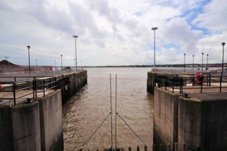
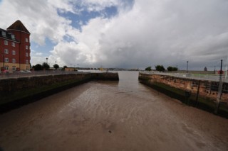
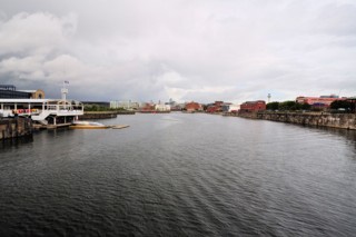
Looking to the South from Brunswick Dock Lock.
|
| Les regards portés vers le Sud de l'Écluse du Dock de Brunswick. |
29-08-2012
Click to enlarge - Cliquer sur l'image pour agrandir |
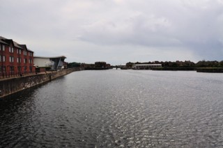
South Ferry Basin seen from the West.
|
| Le Bassin du Ferry Sud vu de l'Ouest. |
29-08-2012
Click to enlarge - Cliquer sur l'image pour agrandir |
South Ferry Basin seen from the East.
|
| Le Bassin du Ferry Sud vu de l'Est. |
Click to enlarge - Cliquer sur l'image pour agrandir |
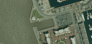
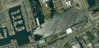
South Ferry Basin seen by Google Earth.
|
| Le Bassin du Ferry Sud vu par Google Earth. |
29-08-2012
Click to enlarge - Cliquer sur l'image pour agrandir |
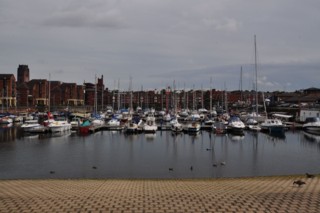
Coburg Dock seen from the West.
|
| Le Dock de Coburg vu de l'Ouest. |
Click to enlarge - Cliquer sur l'image pour agrandir |
Coburg Dock seen by Google Earth.
|
| Le Dock de Coburg vu par Google Earth. |
29-08-2012
Click to enlarge - Cliquer sur l'image pour agrandir |
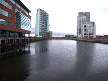
Queen's Dock seen from the South.
|
| Le Dock de la Reine vu du Sud. |
29-08-2012
Click to enlarge - Cliquer sur l'image pour agrandir |
Queen's Dock seen from the North.
|
| Le Dock de la Reine vu du Nord. |
Click to enlarge - Cliquer sur l'image pour agrandir |
Queen's Dock seen by Google Earth.
|
| Le Dock de la Reine vu par Google Earth. |
29-08-2012
Click to enlarge - Cliquer sur l'image pour agrandir |
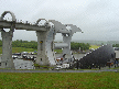
Wapping Bridge seen from the North.
|
| Le Pont de Wapping vu du Nord. |
Click to enlarge - Cliquer sur l'image pour agrandir |
Wapping Bridge seen by Google Earth.
|
| Le Pont de Wapping vu par Google Earth. |
|
Visitez/Bezoek/Visit
Click on the image - cliquer sur l'image |
|
Liverpool Docks. |
|
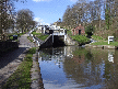
Leeds & Liverpool Canal. |
|
Walking the British Waterways |
|
|