|
Hotwells |
 |
|
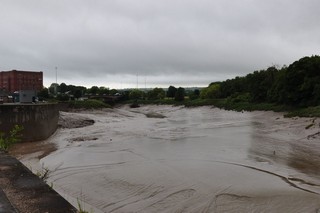
From Avonmouth to Hotwells through the Avon Gorge, the river is tidal and is
navigable by small sea going vessels at high tide. The tide range is very wide and come second only to
de Bay of Fundy on the East coast of Canada.
Only intrepid inland boater will adventure along this strech of the fast flowing river. |
D'Avonmouth à Hotwells en passant par la Gorge d'Avon, la rivière est soumise à la marée dont l'amplitude
est particulièrement importante. Seule, au monde, la baie de Fundy, sur la
côte est du Canada, connaît
des marées plus grandes.
Seuls, les navigateurs intrépides tenteront après une minutieuse préparation à naviguer le long de ce segment de rivière coulant très rapidement. |
Click to enlarge - Cliquer pour agrandir |
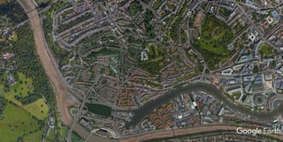
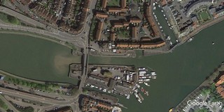
The River Avon and Floating Harbour seen by Google Earth.
|
| L'Avon et 3e Floating Harbour vus par Google Earth. |
20-07-2015

Click to enlarge - Cliquer sur l'image pour agrandir |
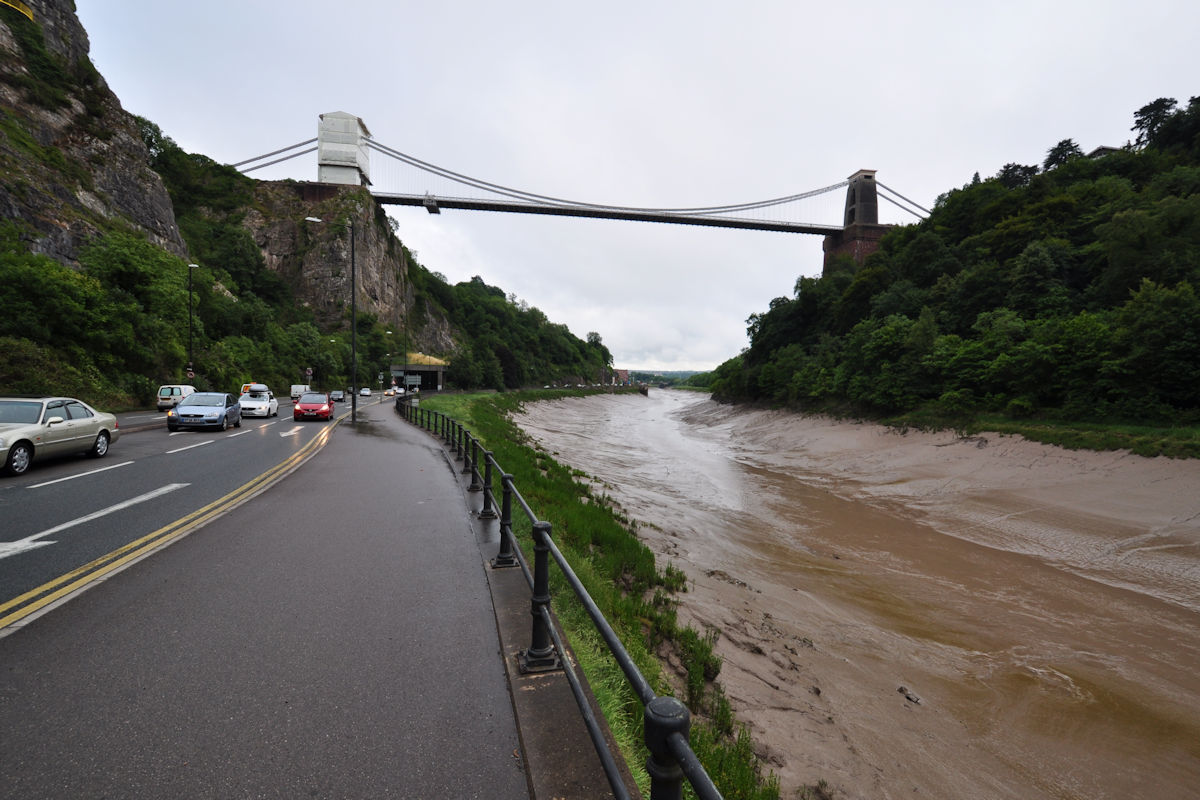
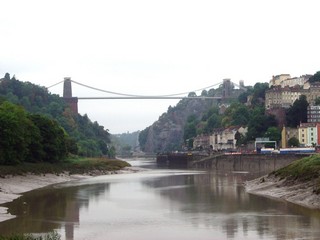
Clifton Suspension Bridge seen from the North. The Clifton Suspension Bridge spanning the River Avon downstream Hotwells. it's the first major commission of Isambard Kingdom Brunel.
|
| Le Pont Suspendu de Clifton vu du Nord. Le pont suspendu de Clifton en aval de Hotwells. c'est le premier grand ouvrage de Isambard Kingdom Brunel. |
20-07-2015
Click to enlarge - Cliquer sur l'image pour agrandir |
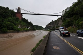
Clifton Suspension Bridge seen from the South.
|
| Le Pont Suspendu de Clifton vu du Sud. |
Click to enlarge - Cliquer sur l'image pour agrandir |
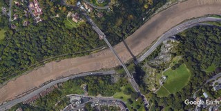
Clifton Suspension Bridge seen by Google Earth.
|
| Le Pont Suspendu de Clifton vu par Google Earth. |
11-09-2005
Click to enlarge - Cliquer pour agrandir |
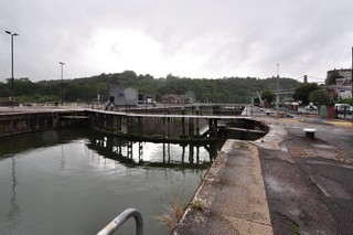
Clifton Suspension Bridge seen from Cumberland Basin Entrance Lock No.2.
|
| Le Pont Suspendu de Clifton vu de l'Écluse n°2 de l'Accès au Bassin de Cumberland. |
11-09-2005
Click to the submenu - Cliquer pour le sous-menu |
The Cumberland Basin Entrance Lock No.2 giving access to Hotwells Port. This lock was built to make Hotwells Port tide free.
|
| L'Écluse n°2 de l'Accès au Bassin de Cumberland. donnant accès au port. Cette écluse avait été construite afin de rendre le port de Hotwells libre de la marée. |
20-07-2015
Click to enlarge - Cliquer sur l'image pour agrandir |
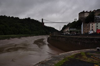
Looking to the North-West, the Avon River seen from Cumberland Basin Entrance Lock No.2.
|
| Les regards portés vers le Nord-ouest, l'Avon vue de l'Écluse n°2 de l'Accès au Bassin de Cumberland. |
11-09-2005
Click to the submenu - Cliquer pour le sous-menu |
The New Cut, a canal allowing the excess of water of the River Avon, to be diverted from Hotwells Port.
|
| La "Nouvelle Coupure", un canal de dérivation permettant aux eaux excédentaires de la rivière Avon de s'écouler hors du port de Hotwells. |
20-07-2015
Click to enlarge - Cliquer sur l'image pour agrandir |
Plimsoli Bridge seen from Cumberland Basin Entrance Lock No.2.
|
| Le Pont de Plimsoli vu de l'Écluse n°2 de l'Accès au Bassin de Cumberland. |
20-07-2015
Click to enlarge - Cliquer sur l'image pour agrandir |
Plimsoli Bridge seen from the East.
|
| Le Pont de Plimsoli vu de l'Est. |
Click to enlarge - Cliquer sur l'image pour agrandir |
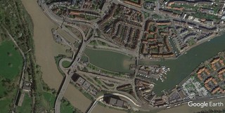
Cumberland Basin seen by Google Earth.
|
| Le Bassin de Cumberland vu par Google Earth. |
20-07-2015
Click to enlarge - Cliquer sur l'image pour agrandir |
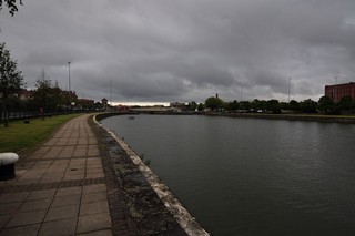
Cumberland Basin seen from Plimsoli Bridge.
|
| Le Bassin de Cumberland vu du Pont de Plimsoli. |
11-09-2005
Click to enlarge - Cliquer pour agrandir | Cumberland Basin.
| Bassin de Cumberland. |
11-09-2005
Click to enlarge - Cliquer pour agrandir |
20-07-2015
Click to enlarge - Cliquer sur l'image pour agrandir |
|
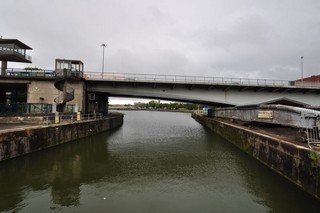
Cumberland Basin Bridge seen from the West. |
Le Pont du Bassin Cumberland vu de l'Ouest. |
20-07-2015
Click to enlarge - Cliquer sur l'image pour agrandir |
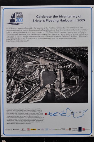
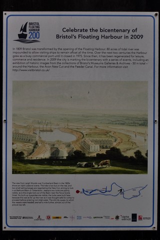
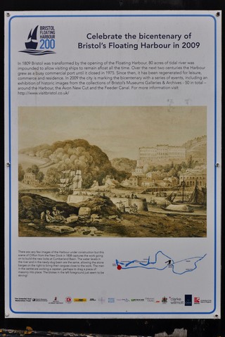
Information Panel.
|
| Panneau d'Information.
20-07-2015
| 
Click to enlarge - Cliquer sur l'image pour agrandir
20-07-2015
| 
Click to enlarge - Cliquer sur l'image pour agrandir |
20-07-2015
Click to enlarge - Cliquer sur l'image pour agrandir |
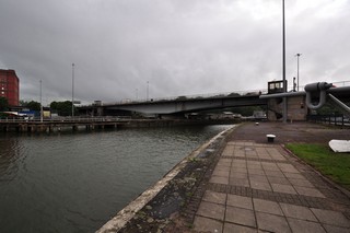
Looking to the West, Cumberland Basin seen from Cumberland Basin Bridge.
|
| Les regards portés vers l'Ouest, le Bassin Cumberland vu du Pont du Bassin Cumberland. |
20-07-2015
Click to enlarge - Cliquer sur l'image pour agrandir |
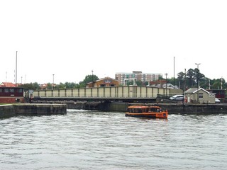
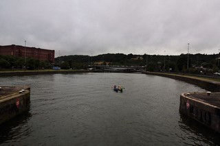
New Junction Lock seen from Cumberland Basin Bridge.
|
| L'Écluse de la Nouvelle Jonction vue du Pont du Bassin Cumberland. |
Click to enlarge - Cliquer sur l'image pour agrandir |
New Junction Lock seen by Google Earth.
|
| L'Écluse de la Nouvelle Jonction vu par Google Earth. |
20-07-2015
Click to enlarge - Cliquer sur l'image pour agrandir |
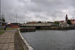
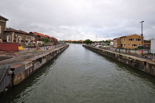
New Junction Lock seen from the East.
|
| L'Écluse de la Nouvelle Jonction vue de l'Est. |
|
Visitez/Bezoek/Visit
Click on the image - cliquer sur l'image |
|
The Kennet & Avon Canal |
|
|