| Nazeing Marsh |
 |
Click to enlarge - Cliquer pour agrandir |
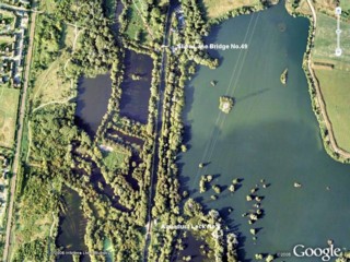
The Lee Navigation to the South of Slipe Lane Bridge No.49 seen by Google Earth.
|
| La Rivière Canalisée Lee au Sud du Pont n°49 de la Slipe Lane vue par Google Earth. |
04-05-2008
Click to enlarge - Cliquer pour agrandir |
29-10-2011
Click to enlarge - Cliquer pour agrandir |
|
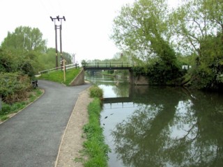
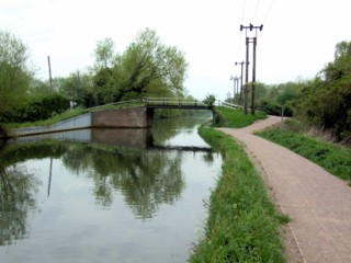
Slipe Lane Bridge No.49 seen from the South. |
Le Pont n°49 de la Slipe Lane vu du Sud. |
04-05-2008
Click to enlarge - Cliquer pour agrandir |
29-10-2011
Click to enlarge - Cliquer pour agrandir |
|
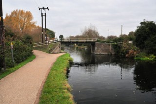
Slipe Lane Bridge No.49 seen from the North. |
Le Pont n°49 de la Slipe Lane vu du Nord. |
Click to enlarge - Cliquer pour agrandir |
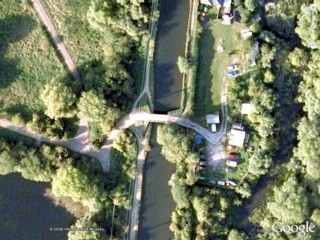
Slipe Lane Bridge No.49 seen by Google Earth.
|
| Le Pont n°49 de la Slipe Lane vu par Google Earth. |
04-05-2008
Click to enlarge - Cliquer pour agrandir |
29-10-2011
Click to enlarge - Cliquer pour agrandir |
|
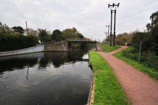
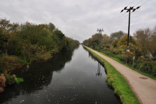
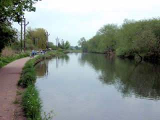
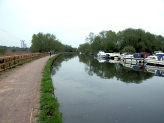
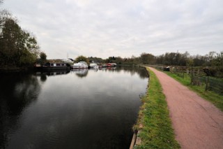
Looking to the South, the Lee Navigation seen from Slipe Lane Bridge No.49. |
Les regards portés vers le Sud, la Rivière Canalisée Lee vu du Pont n°49 de la Slipe Lane. |
04-05-2008
Click to enlarge - Cliquer pour agrandir |
29-10-2011
Click to enlarge - Cliquer pour agrandir |
|
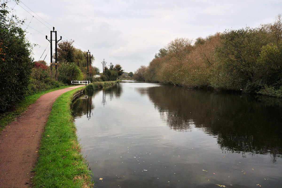
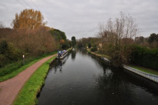
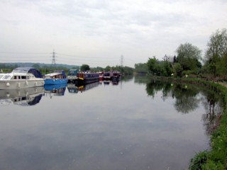
Looking to the North, the Lee Navigation seen from Aqueduct Lock No.8. |
Les regards portés vers le Nord, la Rivière Canalisée Lee vu de l'Ecluse n°8 du Pont Canal. |
29-10-2011
Click to enlarge - Cliquer pour agrandir |
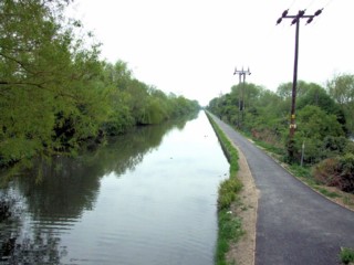
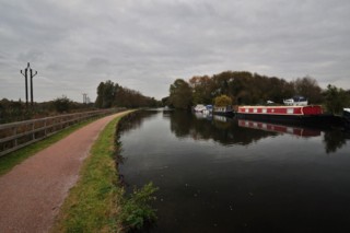
Looking to the South, the Lee Navigation to the North of Slipe Lane Bridge No.49.
|
| Les regards portés vers le Sud, la Lee Canalisée au Nord du Pont n°49 de la Slipe Lane. |
29-10-2011
Click to enlarge - Cliquer pour agrandir |
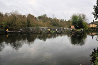
King's Weir.
|
| Le Barrage du Roi. |
Click to enlarge - Cliquer pour agrandir |
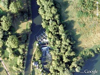
King's Weir seen by Google Earth.
|
| Le Barrage du Roi vue par Google Earth. |
04-05-2008
Click to enlarge - Cliquer pour agrandir |
29-10-2011
Click to enlarge - Cliquer pour agrandir |
|
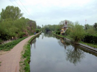
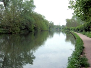
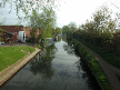
Looking to the South, the Lee Navigation to the North of King's Weir. |
Les regards portés vers le Sud, la Rivière Canalisée Lee au Nord du Barrage du Roi. |
04-05-2008
Click to enlarge - Cliquer pour agrandir |
29-10-2011

Click to enlarge - Cliquer pour agrandir |
|
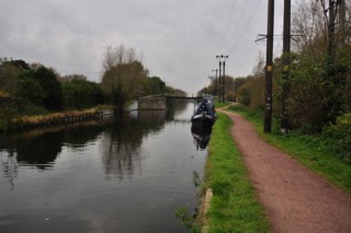
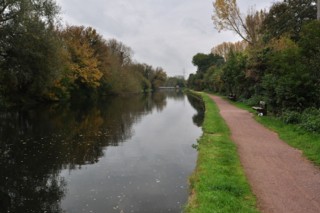
Looking to the North, the Lee Navigation to the North of King's Weir. |
Les regards portés vers le Nord, la Rivière Canalisée Lee au Nord du Barrage du Roi. |
29-10-2011
Click to enlarge - Cliquer pour agrandir |
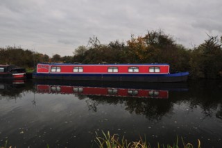
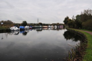
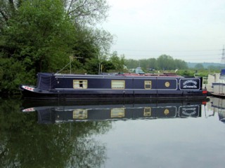
Mooring to the North of King's Weir.
|
| Amarrage au Nord du Barrage du Roi. |
04-05-2008
Click to enlarge - Cliquer pour agrandir |
29-10-2011
Click to enlarge - Cliquer pour agrandir |
|
Looking to the South, the Lee Navigation to the North of King's Weir. |
Les regards portés vers le Sud, la Rivière Canalisée Lee au Nord du Barrage du Roi. |
04-05-2008
Click to enlarge - Cliquer pour agrandir |
29-10-2011
Click to enlarge - Cliquer pour agrandir |
|
Looking to the North, the Lee Navigation to the North of King's Weir. |
Les regards portés vers le Nord, la Rivière Canalisée Lee au Nord du Barrage du Roi. |
04-05-2008
Click to enlarge - Cliquer pour agrandir |
29-10-2011
Click to enlarge - Cliquer pour agrandir |
|
Looking to the South, the Lee Navigation to the North of King's Weir. |
Les regards portés vers le Sud, la Rivière Canalisée Lee au Nord du Barrage du Roi. |
04-05-2008
Click to enlarge - Cliquer pour agrandir |
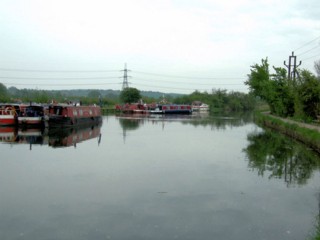
Mooring to the North of King's Weir.
|
| Amarrage au Nord du Barrage du Roi. |
|
Visitez/Bezoek/Visit
Click on the image - cliquer sur l'image |
|
Lee Navigation. |
|
|