|
Bullbridge |
 |
Click to enlarge - Cliquer pour agrandir |
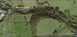
Cromford Canal seen by Google Earth.
|
| Le Canal de Cromford vu par Google Earth. |
Credit: Sabre Maps. Click to enlarge - Cliquer sur l'image pour agrandir |
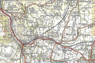
Old OS map of the site of LNER Railway Bridge.
|
| Ancienne carte topographique du site du Pont Ferroviaire de la LNER. |
18-03-2012
Click to enlarge - Cliquer sur l'image pour agrandir |
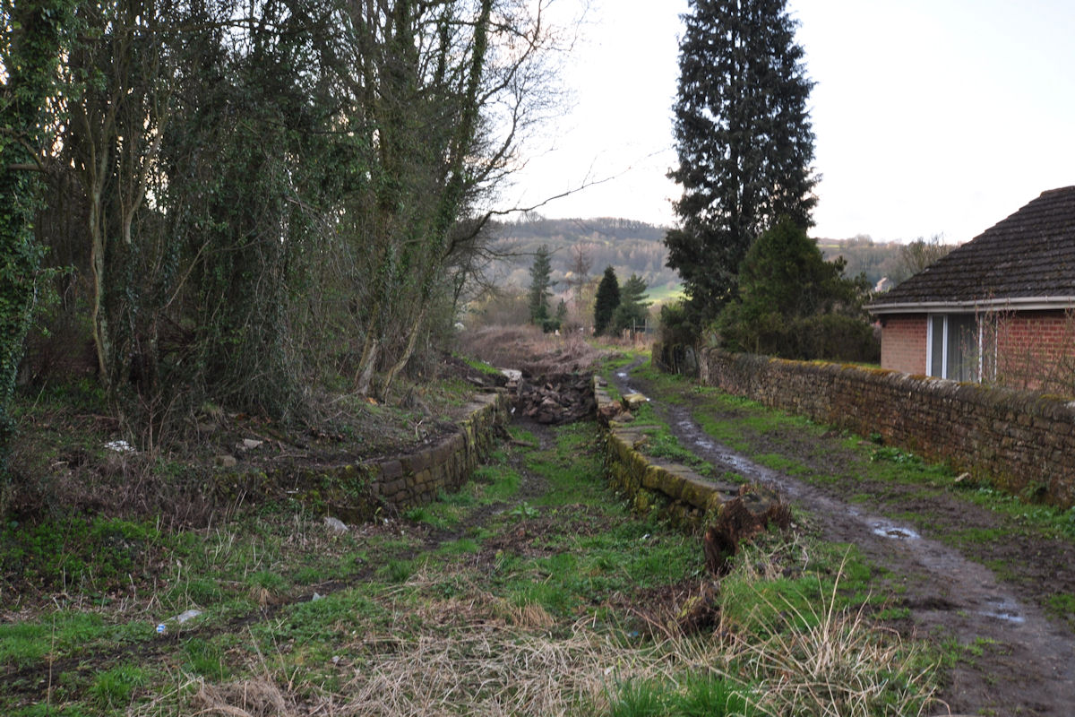
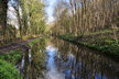
Looking to the East, the site of the Cromford Canal to the East of Sawmills Bridge No.26.
|
| Les regards portés vers l'Est, le site du Canal de Cromford à l'Est du Pont n°26 de Sawmills. |
18-03-2012
Click to enlarge - Cliquer sur l'image pour agrandir |
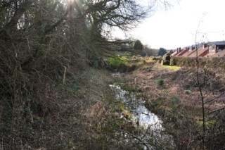
Looking to the West, the site of the Cromford Canal to the East of Sawmills Bridge No.26.
|
| Les regards portés vers l'Ouest, le site du Canal de Cromford à l'Est du Pont n°26 de Sawmills. |
18-03-2012
Click to enlarge - Cliquer sur l'image pour agrandir |
Looking to the East, the site of the Cromford Canal to the East of Sawmills Bridge No.26.
|
| Les regards portés vers l'Est, le site du Canal de Cromford à l'Est du Pont n°26 de Sawmills. |
18-03-2012
Click to enlarge - Cliquer sur l'image pour agrandir |
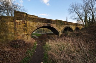
Sawmills Bridge No.26 seen from the East.
|
| Le Pont n°26 de Sawmills vu de l'Est. |
18-03-2012
Click to enlarge - Cliquer sur l'image pour agrandir |
Sawmills Bridge No.26 seen from the West.
|
| Le Pont n°26 de Sawmills vu de l'Ouest. |
18-03-2012
Click to enlarge - Cliquer sur l'image pour agrandir |
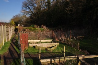
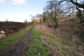
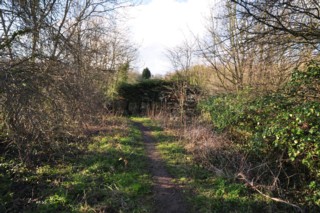
Looking to the East, the site of the Cromford Canal to the West of Sawmills Bridge No.26.
|
| Les regards portés vers l'Est, le site du Canal de Cromford à l'Ouest du Pont n°26 de Sawmills. |
Click to enlarge - Cliquer sur l'image pour agrandir |
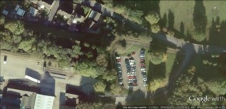
Sawmills Bridge No.26 seen by Google Earth.
|
| Le Pont n°26 de Sawmills vu par Google Earth. |
|
13-03-2012
Click to enlarge - Cliquer sur l'image pour agrandir |
Looking to the East, the site of the Cromford Canal to the East of Bullbridge Narrow.
|
| Les regards portés vers l'Est, le site du Canal de Cromford à l'Est du Retrécissement de Bullbridge. |
Click to enlarge - Cliquer pour agrandir |
Cromford Canal seen by Google Earth.
|
| Le Canal de Cromford vu par Google Earth. |
13-03-2012
Click to enlarge - Cliquer sur l'image pour agrandir |
Bullbridge Narrow seen from the East.
|
| Le Retrécissement de Bullbridge vu de l'Est. |
13-03-2012
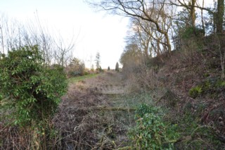
Click to enlarge - Cliquer sur l'image pour agrandir |
Bullbridge Narrow seen from the West.
|
| Le Retrécissement de Bullbridge vu de l'Ouest. |
13-03-2012
Click to enlarge - Cliquer sur l'image pour agrandir |
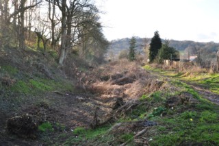
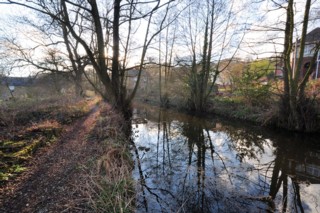
Looking to the West, the site of the Cromford Canal seen from Bullbridge Narrow.
|
| Les regards portés vers l'Ouest, le site du Canal de Cromford vu du Retrécissement de Bullbridge. |
13-03-2012
Click to enlarge - Cliquer sur l'image pour agrandir |
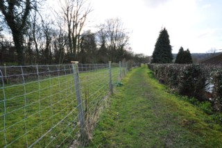
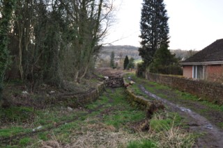
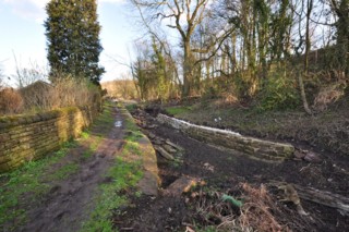
Looking to the East, the site of the Cromford Canal to the West of Bullbridge Narrow.
|
| Les regards portés vers l'Est, le site du Canal de Cromford à l'Ouest du Retrécissement de Bullbridge. |
18-03-2012
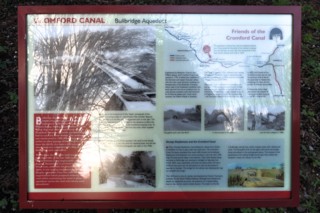
Click to enlarge - Cliquer sur l'image pour agrandir |
Information Panel.
|
| Panneau d'Information. |
18-03-2012
Click to enlarge - Cliquer sur l'image pour agrandir |
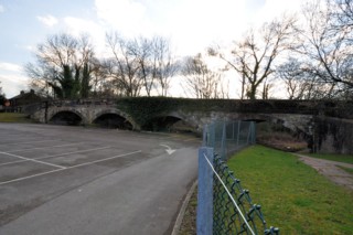
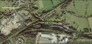
Looking to the North, the site of the Cromford Canal to the North of Bullbridge Aqueduct.
|
| Les regards portés vers le Nord, le site du Canal de Cromford au Nord du Pont Canal de Bullbridge. |
18-03-2012
Click to enlarge - Cliquer sur l'image pour agrandir |
Looking to the West, the site of the Cromford Canal to the East of Bullbridge Bridge No.19.
|
| Les regards portés vers l'Ouest, le site du Canal de Cromford à l'Est du Pont n°19 de Bullbridge. |
Click to enlarge - Cliquer sur l'image pour agrandir |
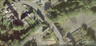
Bullbridge Bridge No.19 seen by Google Earth.
|
| Le Pont n°19 de Bullbridge vu par Google Earth. |
|
Visitez/Bezoek/Visit
Click on the image - cliquer sur l'image |
|
The Cromford Canal |
|
|