|
River Dun Navigation
|
 |
Click to enlarge - Cliquer pour agrandir |
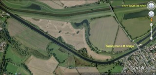
River Dun Navigation seen by Google Earth.
|
| La Dun Canalisée vue par Google Earth. |
1-06-2013
Click to enlarge - Cliquer sur l'image pour agrandir |
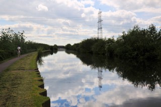
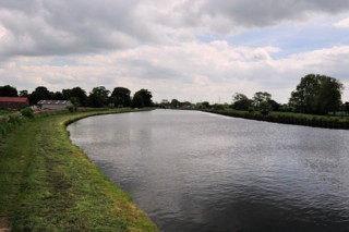
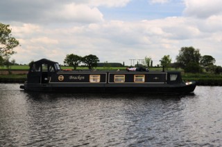
Looking to the South, the River Dun Navigation to the South of Barnby Dun Lift Bridge.
|
| Les regards portés vers le Sud, la Dun Canalisée au Sud du Pont Levant de Barnby Dun. |
1-06-2013

Click to enlarge - Cliquer sur l'image pour agrandir |
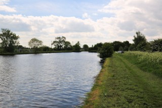
Looking to the North, the River Dun Navigation to the South of Barnby Dun Lift Bridge.
|
| Les regards portés vers le Nord, la Dun Canalisée au Sud du Pont Levant de Barnby Dun. |
1-06-2013
Click to enlarge - Cliquer sur l'image pour agrandir |
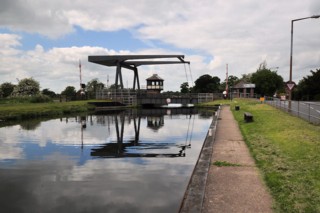
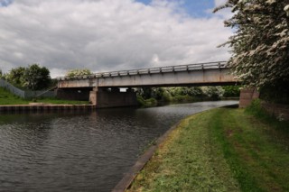
Barnby Dun Lift Bridge seen from the South.
|
| Le Pont Levant de Barnby Dun vu du Sud. |
1-06-2013
Click to enlarge - Cliquer sur l'image pour agrandir |
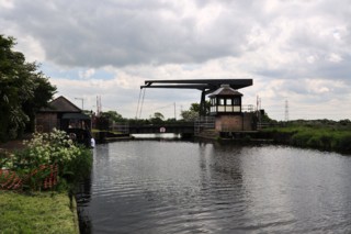
Barnby Dun Lift Bridge seen from the North.
|
| Le Pont Levant de Barnby Dun vu du Nord. |
Click to enlarge - Cliquer sur l'image pour agrandir |
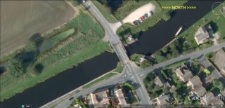
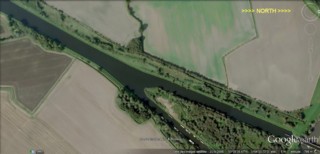
Barnby Dun Lift Bridge seen by Google Earth.
|
| Le Pont Levant de Barnby Dun vu par Google Earth. |
1-06-2013
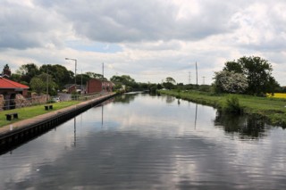
Click to enlarge - Cliquer sur l'image pour agrandir |
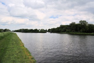
Looking to the South, the River Dun Navigation seen from Barnby Dun Lift Bridge.
|
| Les regards portés vers le Sud, la Dun Canalisée vue du Pont Levant de Barnby Dun. |
1-06-2013
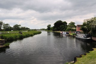
Click to enlarge - Cliquer sur l'image pour agrandir |
Looking to the North, the River Dun Navigation seen from Barnby Dun Lift Bridge.
|
| Les regards portés vers le Nord, la Dun Canalisée vue du Pont Levant de Barnby Dun. |
Click to enlarge - Cliquer pour agrandir |
River Dun Navigation seen by Google Earth.
|
| La Dun Canalisée vue par Google Earth. |
1-06-2013
Click to enlarge - Cliquer sur l'image pour agrandir |
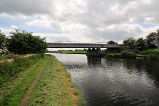
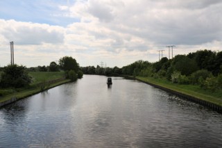
Looking to the South, the Doncaster Cut to the South of Thorpe Bank Railway Bridge.
|
| Les regards portés vers le Sud, la Coupure de Doncaster au Sud du Pont Ferroviaire de Thorpe Bank. |
1-06-2013
Click to enlarge - Cliquer sur l'image pour agrandir |
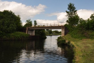
Thorpe Bank Railway Bridge seen from the South.
|
| Le Pont Ferroviaire de Thorpe Bank vu du Sud. |
1-06-2013
Click to enlarge - Cliquer sur l'image pour agrandir |
Thorpe Bank Railway Bridge seen from the North.
|
| Le Pont Ferroviaire de Thorpe Bank vu du Nord. |
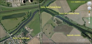
Click to enlarge - Cliquer sur l'image pour agrandir |
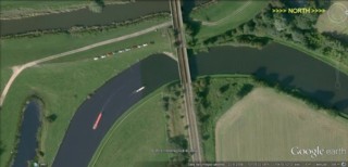
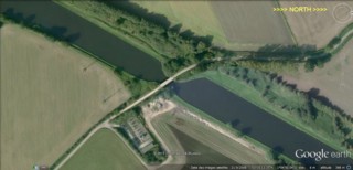
Thorpe Bank Railway Bridge seen by Google Earth.
|
| Le Pont Ferroviaire de Thorpe Bank vu par Google Earth. |
1-06-2013
Click to enlarge - Cliquer sur l'image pour agrandir |
Broad Ings Lane Bridge seen from the South.
|
| Le Pont de la Broad Ings Lane vu du Sud. |
Click to enlarge - Cliquer sur l'image pour agrandir |
Broad Ings Lane Bridge seen by Google Earth.
|
| Le Pont de la Broad Ings Lane vu par Google Earth. |
1-06-2013
Click to enlarge - Cliquer sur l'image pour agrandir |
Looking to the South, the River Dun Navigation seen from Broad Ings Lane Bridge.
|
| Les regards portés vers le Sud, la Dun Canalisée vue du Pont de la Broad Ings Lane. |
1-06-2013
Click to enlarge - Cliquer sur l'image pour agrandir |
Looking to the North, the River Dun Navigation seen from Broad Ings Lane Bridge.
|
| Les regards portés vers le Nord, la Dun Canalisée vue du Pont de la Broad Ings Lane. |
1-06-2013
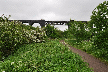
Click to enlarge - Cliquer sur l'image pour agrandir |
To the North of Broad Ings Lane Bridge.
|
| Au Nord du Pont de la Broad Ings Lane. |
1-06-2013
Click to enlarge - Cliquer sur l'image pour agrandir |
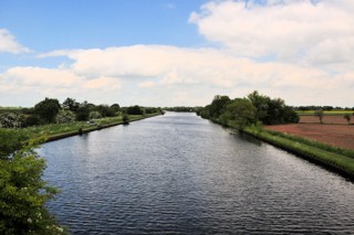
Looking to the South, the River Dun Navigation to the North of Broad Ings Lane Bridge.
|
| Les regards portés vers le Sud, la Dun Canalisée au Nord du Pont de la Broad Ings Lane. |
1-06-2013
Click to enlarge - Cliquer sur l'image pour agrandir |
Bramwith Junction seen from the South.
|
| Le Confluent de Bramwith vu du Sud. |
Click to enlarge - Cliquer sur l'image pour agrandir |
Bramwith Junction seen by Google Earth.
|
| Le Confluent de Bramwith vu par Google Earth. |
|
Visitez/Bezoek/Visit
Click on the image - cliquer sur l'image |
|
River Dun Navigation |
|
|